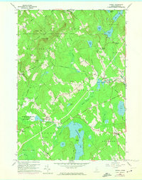
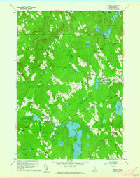
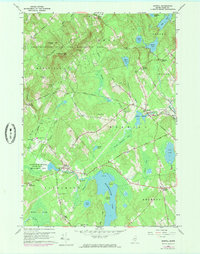
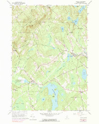
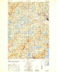
1960 Map of Morrill
USGS Topo · Published 1974About this map
Frye Mountain State Game Management Area dominates the northern highlands of this Waldo County landscape, where the Lookout Tower sits atop the peak of Frye Mtn. The 1960s terrain is defined by a series of family-named corners and small villages, including Morrill and North Searsmont, connected by a network of secondary roads like Center Montville Road and Hartshorn Road.
Find a feature on this map
65 named features on this map. Tap any name to fly to it.
Don’t see what you’re looking for? This feature index may not catch every label — zoom into the map to look around manually.
Map Details
Editions of this 1960 Morrill Map
4 editions found
Other maps of this area

1915 · Belfast
USGS Topo · 1:62,500

1916 · Liberty
USGS Topo · 1:62,500

1917 · Belfast
USGS Topo · 1:62,500

1926 · Burnham
USGS Topo · 1:62,500

1932 · Brooks
USGS Topo · 1:62,500

1941 · Belfast
USGS Topo · 1:62,500

1942 · Liberty
USGS Topo · 1:62,500

1948 · Bangor
USGS Topo · 1:250,000
1950 · Belfast
USGS Topo · 1:50,000

1950 · Liberty
USGS Topo · 1:50,000