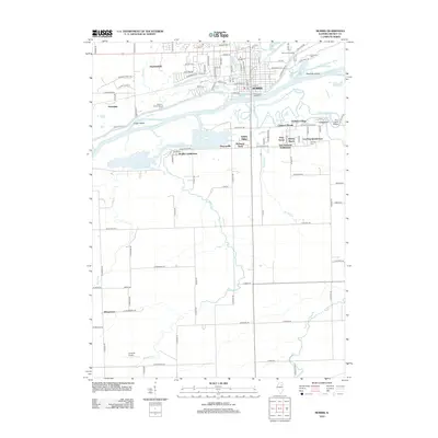
2012 Map of Morris
USGS Topo · Published 2012About this map
The Illinois River bisects this landscape, creating a distinct division between the urban grid of Morris and the evolving residential developments to the south. In the early 21st century, the northern bank displays the established city center, anchored by the Po and historical grounds such as Evergreen Cem and Mount Carmel Cem. The river itself is punctuated by Sugar Island and Peacocks Island, while the southern bank reveals a collection of smaller subdivisions and named clusters like Paytonville, Gaslight Village, and Pebble Beach.
Find a feature on this map
121 named features on this map. Tap any name to fly to it.
Don’t see what you’re looking for? This feature index may not catch every label — zoom into the map to look around manually.
Map Details
Editions of this 2012 Morris Map
This is the sole edition of this map. No revisions or reprints were ever made.
Other maps of this area

1892 · Morris
USGS Topo · 1:62,500

1892 · Marseilles
USGS Topo · 1:62,500

1916 · Marseilles
USGS Topo · 1:62,500

1918 · Morris
USGS Topo · 1:62,500

1940 · Marseilles
USGS Topo · 1:62,500

1948 · Dwight
USGS Topo · 1:62,500

1950 · Dwight
USGS Topo · 1:62,500

1953 · Morris
USGS Topo · 1:24,000

1953 · Lisbon
USGS Topo · 1:24,000

1953 · Coal City
USGS Topo · 1:24,000