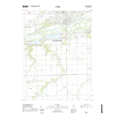
2018 Map of Morris
USGS Topo · Published 2018About this map
The Illinois River flows through the heart of this Grundy County landscape, dominated by the Illinois and Michigan Canal National Heritage Corridor. The city of Morris serves as the primary hub, showing a dense grid of streets including E Main St and W Waverly St, while smaller outlying settlements like Stockdale, Paytonville, and Wauponsee provide a look at the residential and industrial distribution across the river valley. Genealogists will find several burial sites recorded, including Evergreen Cem, Mount Carmel Cem, and the more isolated Sample Cem.
Find a feature on this map
87 named features on this map. Tap any name to fly to it.
Don’t see what you’re looking for? This feature index may not catch every label — zoom into the map to look around manually.
Map Details
Editions of this 2018 Morris Map
This is the sole edition of this map. No revisions or reprints were ever made.
Other maps of this area

1892 · Morris
USGS Topo · 1:62,500

1892 · Marseilles
USGS Topo · 1:62,500

1916 · Marseilles
USGS Topo · 1:62,500

1918 · Morris
USGS Topo · 1:62,500

1940 · Marseilles
USGS Topo · 1:62,500

1948 · Dwight
USGS Topo · 1:62,500

1950 · Dwight
USGS Topo · 1:62,500

1953 · Morris
USGS Topo · 1:24,000

1953 · Lisbon
USGS Topo · 1:24,000

1953 · Coal City
USGS Topo · 1:24,000