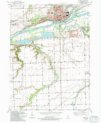
1993 Map of Morris
USGS Topo · Published 1994About this map
The Illinois River corridor near Morris forms the backbone of this topographic study, where the historic Illinois and Michigan Canal runs parallel to the main waterway. This landscape reflects a dense intersection of river-based commerce and conservation, anchored by Gebhard Woods State Park and the William Stratton State Access Area. The confluence of Nettle Creek and the Mazon River with the Illinois creates a complex network of wetlands and sloughs, including Mud Slough and Peacock Slough.
Find a feature on this map
51 named features on this map. Tap any name to fly to it.
Don’t see what you’re looking for? This feature index may not catch every label — zoom into the map to look around manually.
Map Details
Editions of this 1993 Morris Map
This is the sole edition of this map. No revisions or reprints were ever made.
Other maps of this area

1892 · Morris
USGS Topo · 1:62,500

1892 · Marseilles
USGS Topo · 1:62,500

1916 · Marseilles
USGS Topo · 1:62,500

1918 · Morris
USGS Topo · 1:62,500

1940 · Marseilles
USGS Topo · 1:62,500

1948 · Dwight
USGS Topo · 1:62,500

1950 · Dwight
USGS Topo · 1:62,500

1953 · Morris
USGS Topo · 1:24,000

1953 · Lisbon
USGS Topo · 1:24,000

1953 · Coal City
USGS Topo · 1:24,000