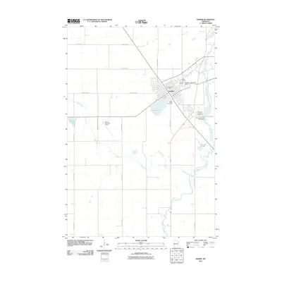
2010 Map of Morris
USGS Topo · Published 2010About this map
Morris serves as the focal point of this Stevens County landscape, where the University of Minnesota at Morris and the Stevens County Fairgrounds dominate the town’s eastern and southern edges. The geography is defined by the winding path of the Pomme de Terre River and its accompanying Pomme de Terre River Dam, which create local landmarks like the Pomme De Terre Campground. Beyond the residential grid, the terrain is shaped by water features such as Crystal Lake and the meandering Muddy Creek. Local history and genealogy interest is anchored by the Stevens Post Office and the neighboring Summit Cemetery and Calvary Cemetery, providing a detailed view of the community's civic and social infrastructure in the early 21st century.
Find a feature on this map
24 named features on this map. Tap any name to fly to it.
Don’t see what you’re looking for? This feature index may not catch every label — zoom into the map to look around manually.
Map Details
Editions of this 2010 Morris Map
This is the sole edition of this map. No revisions or reprints were ever made.
Other maps of this area

1910 · Chokio
USGS Topo · 1:62,500

1912 · Chokio
USGS Topo · 1:62,500

1912 · Morris
USGS Topo · 1:62,500

1953 · Milbank
USGS Topo · 1:250,000

1953 · Saint Cloud
USGS Topo · 1:250,000

1957 · Saint Cloud
USGS Topo · 1:250,000

1958 · Milbank
USGS Topo · 1:250,000

1958 · Saint Cloud
USGS Topo · 1:250,000

1968 · Dry Wood Lake
USGS Topo · 1:24,000

1968 · Hancock
USGS Topo · 1:24,000