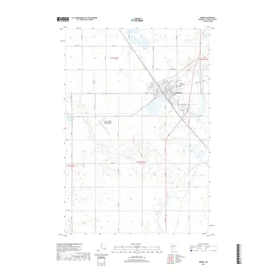
2019 Map of Morris
USGS Topo · Published 2019About this map
Morris serves as the regional hub of Stevens County, centered around the Univ of Minnesota Morris campus and the winding course of the Pomme de Terre River. The town's grid is oriented diagonally along the railway corridor, with streets such as Atlantic Ave and Pacific Ave defining the central business district. To the south and west, the landscape opens into a complex network of wetlands and glacial features, including Crystal Lake and the broad depressions of Spooner Slough and Coleman Slough. The Morris Municipal Airport - Charlie Schmidt Field occupies the flat terrain west of town, while smaller waterways like Muddy Cr drain the agricultural lands that dominate the surrounding township boundaries. Local history is anchored by established sites like Summit Cem and Calvary Cem, which overlook the river valley.
Find a feature on this map
56 named features on this map. Tap any name to fly to it.
Don’t see what you’re looking for? This feature index may not catch every label — zoom into the map to look around manually.
Map Details
Editions of this 2019 Morris Map
This is the sole edition of this map. No revisions or reprints were ever made.
Other maps of this area

1910 · Chokio
USGS Topo · 1:62,500

1912 · Chokio
USGS Topo · 1:62,500

1912 · Morris
USGS Topo · 1:62,500

1953 · Milbank
USGS Topo · 1:250,000

1953 · Saint Cloud
USGS Topo · 1:250,000

1957 · Saint Cloud
USGS Topo · 1:250,000

1958 · Milbank
USGS Topo · 1:250,000

1958 · Saint Cloud
USGS Topo · 1:250,000

1968 · Dry Wood Lake
USGS Topo · 1:24,000

1968 · Hancock
USGS Topo · 1:24,000