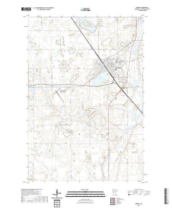
2022 Map of Morris
USGS Topo · Published 2022About this map
The city of Morris serves as a regional hub in Stevens County, defined by its institutional architecture and organized grid. The campus of the University of Minnesota Morris and the Stevens County District Courthouse anchor the central townsite, while the Morris Municipal Airport - Charlie Schmidt Field occupies the prairie land to the west. This landscape is a mosaic of agriculture and water, where the meandering Pomme de Terre River and Muddy Cr cut through the glacial till. Significant wetlands and basins like Spooner Slough, Coleman Slough, and Crystal Lake are preserved among the section lines, illustrating the tension between the natural hydrology of the Red River Valley edge and the rigid demands of the Public Land Survey System. Local heritage is further marked by the presence of Summit Cem and Calvary Cem on the town's northern and eastern fringes.
Find a feature on this map
47 named features on this map. Tap any name to fly to it.
Don’t see what you’re looking for? This feature index may not catch every label — zoom into the map to look around manually.
Map Details
Editions of this 2022 Morris Map
This is the sole edition of this map. No revisions or reprints were ever made.
Other maps of this area

1910 · Chokio
USGS Topo · 1:62,500

1912 · Chokio
USGS Topo · 1:62,500

1912 · Morris
USGS Topo · 1:62,500

1953 · Milbank
USGS Topo · 1:250,000

1953 · Saint Cloud
USGS Topo · 1:250,000

1957 · Saint Cloud
USGS Topo · 1:250,000

1958 · Milbank
USGS Topo · 1:250,000

1958 · Saint Cloud
USGS Topo · 1:250,000

1968 · Dry Wood Lake
USGS Topo · 1:24,000

1968 · Hancock
USGS Topo · 1:24,000