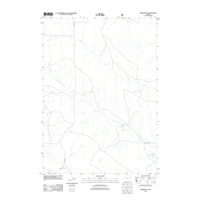
2012 Map of Morrisey SE
USGS Topo · Published 2012About this map
Robbers Roost Cr and its tributaries carve a complex drainage pattern across this corner of Weston County, illustrating the arid water-management priorities of the high plains. The landscape is defined by the presence of significant ranching or livestock infrastructure, most notably the House Reservoir and Robbers Roost Reservoir situated near the intersection of several remote thoroughfares. In this early 21st-century survey, the sparse road network, including Morrissey Rd and Cheyenne River Rd, emphasizes the isolation of the terrain. The hydrological system is further detailed through labels for Sheep Cr, Alkali Cr, and Bobcat Cr, which together form a network of seasonal or intermittent flows typical of the Wyoming interior. This topographic study captures a moment in time when the physical geography remained largely undisturbed by major development, centered instead on the vital reservoirs that support the region.
Find a feature on this map
10 named features on this map. Tap any name to fly to it.
Don’t see what you’re looking for? This feature index may not catch every label — zoom into the map to look around manually.
Map Details
Editions of this 2012 Morrisey SE Map
This is the sole edition of this map. No revisions or reprints were ever made.
Other maps of this area

1899 · Newcastle
USGS Topo · 1:125,000

1901 · Newcastle
USGS Topo · 1:125,000

1951 · Owens
USGS Topo · 1:24,000

1951 · Dewey SW
USGS Topo · 1:24,000

1951 · Morrisey NE
USGS Topo · 1:24,000

1955 · Newcastle
USGS Topo · 1:250,000

1958 · Newcastle
USGS Topo · 1:250,000

1978 · Riverview
USGS Topo · 1:24,000

1979 · Newcastle
USGS Topo · 1:100,000

1981 · Threemile Butte
USGS Topo · 1:24,000