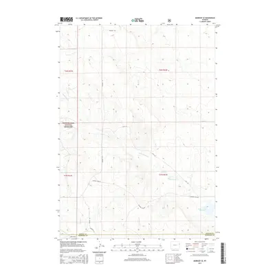
2015 Map of Morrisey SE
USGS Topo · Published 2015About this map
Thunder Basin National Grassland encompasses a significant portion of this high plains landscape, where the vast open range is defined by ephemeral waterways and cattle-country infrastructure. The terrain is deeply incised by the drainages of Sheep Cr, Bobcat Cr, and Robbers Roost Cr, the latter of which feeds into both the House Reservoir and the Robbers Roost Reservoir. These man-made water sources are critical features in an arid environment traditionally used for ranching. A network of rural roads, including Morrissey Rd and Cheyenne River Rd, provides the primary access across the county line between Weston Co and Niobrara Co. The map illustrates a classic Western landscape of section lines and remote draws, such as Burn Draw, which highlight the sparse settlement patterns and the essential reliance on local hydrology.
Find a feature on this map
17 named features on this map. Tap any name to fly to it.
Don’t see what you’re looking for? This feature index may not catch every label — zoom into the map to look around manually.
Map Details
Editions of this 2015 Morrisey SE Map
This is the sole edition of this map. No revisions or reprints were ever made.
Other maps of this area

1899 · Newcastle
USGS Topo · 1:125,000

1901 · Newcastle
USGS Topo · 1:125,000

1951 · Owens
USGS Topo · 1:24,000

1951 · Dewey SW
USGS Topo · 1:24,000

1951 · Morrisey NE
USGS Topo · 1:24,000

1955 · Newcastle
USGS Topo · 1:250,000

1958 · Newcastle
USGS Topo · 1:250,000

1978 · Riverview
USGS Topo · 1:24,000

1979 · Newcastle
USGS Topo · 1:100,000

1981 · Threemile Butte
USGS Topo · 1:24,000