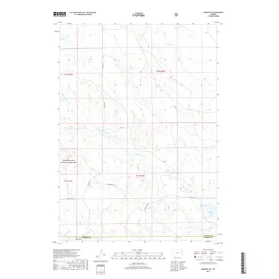
2017 Map of Morrisey SE
USGS Topo · Published 2017About this map
Thunder Basin National Grassland dominates the western portion of this high plains landscape, where the border of Weston and Niobrara counties cuts through the southern reaches. The drainage pattern is defined by several intermittent streams, most notably Sheep Creek and Robbers Roost Creek, which carve winding paths through the terrain. Evidence of water management in this arid environment appears through man-made catchments like House Reservoir and Robbers Roost Reservoir. Rural transit in the early twenty-first century is facilitated by a network of local routes including Morrissey Rd and Cheyenne River Rd, which connect isolated ranching areas. The landscape is further marked by distinct geological features such as Burn Draw, while Akali Creek and Bobcat Creek drain the southernmost sections toward the county line.
Find a feature on this map
16 named features on this map. Tap any name to fly to it.
Don’t see what you’re looking for? This feature index may not catch every label — zoom into the map to look around manually.
Map Details
Editions of this 2017 Morrisey SE Map
This is the sole edition of this map. No revisions or reprints were ever made.
Other maps of this area

1899 · Newcastle
USGS Topo · 1:125,000

1901 · Newcastle
USGS Topo · 1:125,000

1951 · Owens
USGS Topo · 1:24,000

1951 · Dewey SW
USGS Topo · 1:24,000

1951 · Morrisey NE
USGS Topo · 1:24,000

1955 · Newcastle
USGS Topo · 1:250,000

1958 · Newcastle
USGS Topo · 1:250,000

1978 · Riverview
USGS Topo · 1:24,000

1979 · Newcastle
USGS Topo · 1:100,000

1981 · Threemile Butte
USGS Topo · 1:24,000