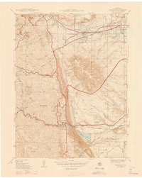
1947 Map of Morrison
USGS Topo · Published 1947About this map
The Hogback and the foothills of the Front Range dominate this 1938 survey, illustrating the complex geography where the plains meet the mountains west of Denver. The town of Golden sits at the northern edge, anchored by the Colorado School of Mines and the State Reformatory, while the State Military Reservation Camp George West occupies a significant portion of the plateau beneath South Table Mountain.
Find a feature on this map
49 named features on this map. Tap any name to fly to it.
Don’t see what you’re looking for? This feature index may not catch every label — zoom into the map to look around manually.
Map Details
Editions of this 1947 Morrison Map
2 editions found
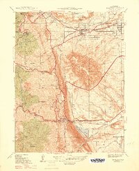
Other maps of this area

1899 · West Denver
USGS Topo · 1:125,000

1906 · Blackhawk
USGS Topo · 1:62,500

1938 · Morrison
USGS Topo · 1:24,000

1939 · Golden
USGS Topo · 1:24,000

1941 · Arvada
USGS Topo · 1:31,680

1941 · Fort Logan
USGS Topo · 1:31,680

1942 · Morrison
USGS Topo · 1:31,680

1942 · Golden
USGS Topo · 1:31,680

1942 · Littleton
USGS Topo · 1:31,680

1942 · Ralston Buttes
USGS Topo · 1:24,000