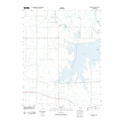
2009 Map of Morrison NE
USGS Topo · Published 2009About this map
The Otoe-Missouria Indian Agency is a focal point of this North Central Oklahoma landscape, reflecting the enduring presence of the Otoe-Missouria Tribe in the region. The map reveals a territory defined by complex water management and Indigenous heritage, notably featuring both the Otoe-Missouria Cemetery and the Cleghorn Cemetery. Significant hydrological features dominate the eastern half of the sheet, where the expanse of Sooner Lake serves as a major reservoir, fed by Greasy Creek. To the north, the Arkansas River meanders near Beaver Island, while Red Rock Creek winds across the upper sections of the quadrangle. The infrastructure of the early 21st century is evident in the numerous small dams and reservoirs, such as Oknoname 103008 Reservoir and the Longbranch Site 7a Dam, which sit alongside a grid of rural section roads like n3300 RD and e0370 RD.
Find a feature on this map
30 named features on this map. Tap any name to fly to it.
Don’t see what you’re looking for? This feature index may not catch every label — zoom into the map to look around manually.
Map Details
Editions of this 2009 Morrison NE Map
This is the sole edition of this map. No revisions or reprints were ever made.
Other maps of this area

1930 · Pawnee
USGS Topo · 1:62,500

1936 · Belford
USGS Topo · 1:62,500

1936 · Pawnee
USGS Topo · 1:62,500

1955 · Enid
USGS Topo · 1:250,000

1958 · Enid
USGS Topo · 1:250,000

1968 · Marland
USGS Topo · 1:24,000

1968 · Ponca City SE
USGS Topo · 1:24,000

1972 · Morrison NE
USGS Topo · 1:24,000

1972 · Morrison
USGS Topo · 1:24,000

1972 · Red Rock
USGS Topo · 1:24,000