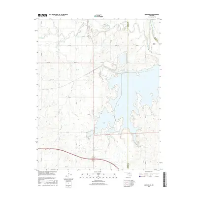
2016 Map of Morrison NE
USGS Topo · Published 2016About this map
The Otoe-Missouria Cem and Cleghorn Cem stand as significant cultural landmarks in this rural landscape at the intersection of Noble, Pawnee, and Osage counties. Much of the geography is defined by the expansive waters of Sooner Lake, which dominates the central and southern portions of the sheet. To the north, the terrain transitions into a complex drainage system where Red Rock Creek meanders toward its confluence with the Arkansas River, the latter forming a natural boundary in the northeast corner near Beaver Island. The area's relief is punctuated by Ute Bluff, rising above the surrounding creeks and drainage basins. A grid of section-line roads like Valley Rd and Ranch Rd provides access to the interior, reflecting a pattern of modern land management and agricultural utility that characterizes this part of Oklahoma.
Find a feature on this map
39 named features on this map. Tap any name to fly to it.
Don’t see what you’re looking for? This feature index may not catch every label — zoom into the map to look around manually.
Map Details
Editions of this 2016 Morrison NE Map
This is the sole edition of this map. No revisions or reprints were ever made.
Other maps of this area

1930 · Pawnee
USGS Topo · 1:62,500

1936 · Belford
USGS Topo · 1:62,500

1936 · Pawnee
USGS Topo · 1:62,500

1955 · Enid
USGS Topo · 1:250,000

1958 · Enid
USGS Topo · 1:250,000

1968 · Marland
USGS Topo · 1:24,000

1968 · Ponca City SE
USGS Topo · 1:24,000

1972 · Morrison NE
USGS Topo · 1:24,000

1972 · Morrison
USGS Topo · 1:24,000

1972 · Red Rock
USGS Topo · 1:24,000