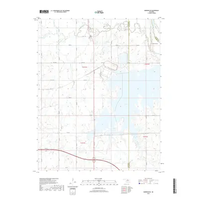
2018 Map of Morrison NE
USGS Topo · Published 2018About this map
Sooner Lake dominates the central and eastern portions of this landscape, its irregular shoreline reaching into the drainage basins of Coon Creek and Cat Creek. Near the northern border, the Arkansas River cuts across the corner of the map, where Beaver Island sits at the junction of Osage Co and Pawnee Co. The tribal history of the region is anchored by the Otoe-Missouria Cem located along Red Rock Creek, providing a focal point for genealogical research in this part of Noble County.
Find a feature on this map
34 named features on this map. Tap any name to fly to it.
Don’t see what you’re looking for? This feature index may not catch every label — zoom into the map to look around manually.
Map Details
Editions of this 2018 Morrison NE Map
This is the sole edition of this map. No revisions or reprints were ever made.
Other maps of this area

1930 · Pawnee
USGS Topo · 1:62,500

1936 · Belford
USGS Topo · 1:62,500

1936 · Pawnee
USGS Topo · 1:62,500

1955 · Enid
USGS Topo · 1:250,000

1958 · Enid
USGS Topo · 1:250,000

1968 · Marland
USGS Topo · 1:24,000

1968 · Ponca City SE
USGS Topo · 1:24,000

1972 · Morrison NE
USGS Topo · 1:24,000

1972 · Morrison
USGS Topo · 1:24,000

1972 · Red Rock
USGS Topo · 1:24,000