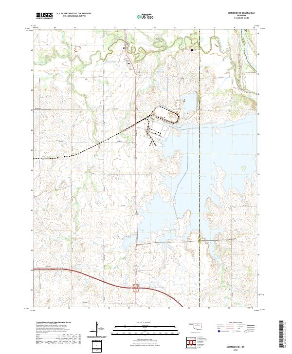
2022 Map of Morrison NE
USGS Topo · Published 2022About this map
Sooner Lake dominates the central geography of this region where the borders of Noble, Pawnee, and Osage Counties converge. The landscape is defined by the winding course of the Arkansas River in the northeast corner, which created Beaver Island, and the drainage patterns of Red Rock Creek and its many tributaries. For genealogists and local historians, the presence of the Otoe Missouria Cem and Cleghorn Cem offers specific points of interest regarding the area's residents and heritage. Evidence of the early ranching and agricultural economy is visible through the network of section-line roads, including Ranch Rd and Valley Rd, and the small settlement at Ute Bluff. The map provides a detailed view of the terrain before more modern developments, showing the numerous creeks like Bird Cr, Coon Cr, and Long Br that feed into the larger basin.
Find a feature on this map
30 named features on this map. Tap any name to fly to it.
Don’t see what you’re looking for? This feature index may not catch every label — zoom into the map to look around manually.
Map Details
Editions of this 2022 Morrison NE Map
This is the sole edition of this map. No revisions or reprints were ever made.
Other maps of this area

1930 · Pawnee
USGS Topo · 1:62,500

1936 · Belford
USGS Topo · 1:62,500

1936 · Pawnee
USGS Topo · 1:62,500

1955 · Enid
USGS Topo · 1:250,000

1958 · Enid
USGS Topo · 1:250,000

1968 · Marland
USGS Topo · 1:24,000

1968 · Ponca City SE
USGS Topo · 1:24,000

1972 · Morrison NE
USGS Topo · 1:24,000

1972 · Morrison
USGS Topo · 1:24,000

1972 · Red Rock
USGS Topo · 1:24,000