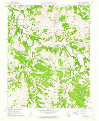
1961 Map of Morrisville
USGS Topo · Published 1962About this map
Morrisville stands as a focal point of this southwestern Missouri landscape, situated near the headwaters of the Little Sac River and the St Louis - San Francisco railroad line. The map captures a transition between the elevated terrain of Grisham Knob and the fertile bottomlands where the North Dry Sac River and Tinkle Branch converge. This era of rural development is marked by a network of small community centers, including Sacville and several country churches that served the surrounding farmsteads.
Find a feature on this map
26 named features on this map. Tap any name to fly to it.
Don’t see what you’re looking for? This feature index may not catch every label — zoom into the map to look around manually.
Map Details
Editions of this 1961 Morrisville Map
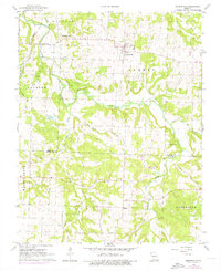
2 editions found
Other maps of this area

1884 · Springfield
USGS Topo · 1:125,000

1884 · Bolivar
USGS Topo · 1:125,000

1886 · Stockton
USGS Topo · 1:125,000

1886 · Greenfield
USGS Topo · 1:125,000

1886 · Springfield
USGS Topo · 1:125,000

1888 · Greenfield
USGS Topo · 1:125,000

1892 · Bolivar
USGS Topo · 1:125,000

1948 · Willard
USGS Topo · 1:24,000

1948 · Ebenezer
USGS Topo · 1:24,000

1954 · Springfield
USGS Topo · 1:250,000