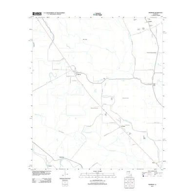
2012 Map of Morrow
USGS Topo · Published 2012About this map
Morrow and Goudeau anchor this rural landscape in Avoyelles Parish, where the complex hydrology of the Louisiana basin is marked by a network of waterways including Bayou Rouge and the State Canal. The region's agricultural and industrial character is evident in the presence of the Big Cane Gas Field and the Morrow Strip Airport, alongside smaller settlements like Le Moyen and Big Cane. A significant number of family and community burial grounds are found throughout the area, such as Robinson Cem, Hebert Cem, and Saint Lukes Cem, providing essential points of reference for genealogists. The terrain transitions between named areas like Gum Ridge and the broad Prairie Du Bayou Rouge, while local transportation is defined by numerous parish roads and spurs, including Richards Spur and Joe Lipoma Rd.
Find a feature on this map
58 named features on this map. Tap any name to fly to it.
Don’t see what you’re looking for? This feature index may not catch every label — zoom into the map to look around manually.
Map Details
Editions of this 2012 Morrow Map
This is the sole edition of this map. No revisions or reprints were ever made.
Other maps of this area

1939 · Opelousas
USGS Topo · 1:62,500

1948 · Bunkie
USGS Topo · 1:62,500

1952 · Lake Charles
USGS Topo · 1:250,000

1954 · Lake Charles
USGS Topo · 1:250,000

1954 · Baton Rouge
USGS Topo · 1:250,000

1955 · Odenburg
USGS Topo · 1:62,500

1956 · Opelousas
USGS Topo · 1:62,500

1956 · Baton Rouge
USGS Topo · 1:250,000

1957 · Opelousas
USGS Topo · 1:62,500

1959 · Palmetto
USGS Topo · 1:62,500