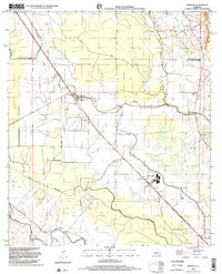
1998 Map of Morrow
USGS Topo · Published 2002About this map
Morrow and Big Cane anchor this portion of the Avoyelles Parish and St Landry Parish borderlands, where the landscape is defined by a dense network of watercourses and early transportation routes. The Union Pacific Railroad cuts a diagonal path through the terrain, passing through the industrial hub at Richards Spur near Le Moyen. This area shows a significant concentration of local heritage sites, including the Lincoln Sch and numerous community landmarks like Antioch Ch and St Marks Ch.
Find a feature on this map
33 named features on this map. Tap any name to fly to it.
Don’t see what you’re looking for? This feature index may not catch every label — zoom into the map to look around manually.
Map Details
Editions of this 1998 Morrow Map
This is the sole edition of this map. No revisions or reprints were ever made.
Other maps of this area

1939 · Opelousas
USGS Topo · 1:62,500

1948 · Bunkie
USGS Topo · 1:62,500

1952 · Lake Charles
USGS Topo · 1:250,000

1954 · Lake Charles
USGS Topo · 1:250,000

1954 · Baton Rouge
USGS Topo · 1:250,000

1955 · Odenburg
USGS Topo · 1:62,500

1956 · Opelousas
USGS Topo · 1:62,500

1956 · Baton Rouge
USGS Topo · 1:250,000

1957 · Opelousas
USGS Topo · 1:62,500

1959 · Palmetto
USGS Topo · 1:62,500