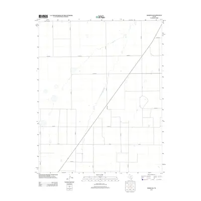
2012 Map of Morse SE
USGS Topo · Published 2012About this map
Horse Cr meanders through this section of the Texas Panhandle in Hutchinson County, providing the primary drainage for a landscape organized by a rigorous grid of ranch and farm roads. This 2012 survey captures the area's modern agricultural and ranching infrastructure, defined by arterial routes like Fm-281 and Co Hwy-18. The map reveals a high density of rural tracks and county roads, including Ranch Road 520 and Co Road Cc, which segment the plains into large parcels. While predominantly open country, the distribution of these routes reflects the enduring importance of local transport networks in the high plains economy, where water features like Horse Cr remain key topographic landmarks among the surveyed sections.
Find a feature on this map
17 named features on this map. Tap any name to fly to it.
Don’t see what you’re looking for? This feature index may not catch every label — zoom into the map to look around manually.
Map Details
Editions of this 2012 Morse SE Map
This is the sole edition of this map. No revisions or reprints were ever made.
Other maps of this area

1953 · Stinnett Station
USGS Topo · 1:24,000

1953 · Pringle
USGS Topo · 1:24,000

1954 · Perryton
USGS Topo · 1:250,000

1954 · Amarillo
USGS Topo · 1:250,000

1958 · Perryton
USGS Topo · 1:250,000

1958 · Amarillo
USGS Topo · 1:250,000

1962 · Hansford
USGS Topo · 1:24,000

1962 · Spearman
USGS Topo · 1:24,000

1974 · Morse
USGS Topo · 1:24,000

1974 · Hannas Draw East
USGS Topo · 1:24,000