2016 Map of Morse SE
USGS Topo · Published 2016About this map
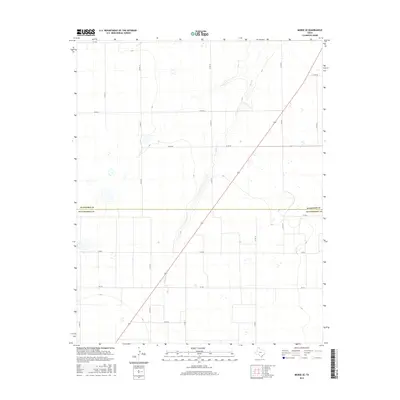
The High Plains of the Texas Panhandle are defined here by the open drainage of Horse Cr, which snakes through the center of this landscape in Hutchinson and Hansford counties. During the mid-2010s, this area remained a quintessential section of the Llano Estacado, where the rectilinear grid of county roads, such as Co Rd 16 and Co Rd 18, reveals a systematic approach to ranching and agricultural land use. The boundary between Hansford Co and Hutchinson Co bisects the map, marking a transition in local jurisdiction across these wide plains. Infrastructure is primarily dedicated to transportation and resource access, anchored by state-maintained routes like FM 281 and FM 520. The map illustrates a landscape of intermittent water features and depressions characteristic of the region's geography, providing a clear record of rural Texas before further modern development or changes in land ownership patterns.
Find a feature on this map
17 named features on this map. Tap any name to fly to it.
Don’t see what you’re looking for? This feature index may not catch every label — zoom into the map to look around manually.
Map Details
Editions of this 2016 Morse SE Map
This is the sole edition of this map. No revisions or reprints were ever made.
Other maps of this area

1953 · Stinnett Station
USGS Topo · 1:24,000

1953 · Pringle
USGS Topo · 1:24,000

1954 · Perryton
USGS Topo · 1:250,000

1954 · Amarillo
USGS Topo · 1:250,000

1958 · Perryton
USGS Topo · 1:250,000

1958 · Amarillo
USGS Topo · 1:250,000

1962 · Hansford
USGS Topo · 1:24,000

1962 · Spearman
USGS Topo · 1:24,000

1974 · Morse
USGS Topo · 1:24,000

1974 · Hannas Draw East
USGS Topo · 1:24,000