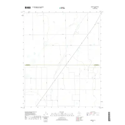
2019 Map of Morse SE
USGS Topo · Published 2019About this map
Horse Cr serves as the primary drainage feature through this stretch of the Texas Panhandle, carving a shallow path across the high plains. The landscape is defined by the straight-line grid of the Public Land Survey System, with numerous county roads like Co Rd CC and Co Rd DD following section boundaries. This area marks the political transition where Hansford Co meets Hutchinson Co, reflecting the region’s agricultural and ranching organization. The transport network is anchored by State Hwy 51 and secondary routes such as FM 281, which connect the scattered homesteads and industrial sites typical of this energy-producing corner of Texas. Large-scale topographic shifts are minimal, with the map recording the subtle depressions and drainage patterns that characterize the plains' hydrology.
Find a feature on this map
18 named features on this map. Tap any name to fly to it.
Don’t see what you’re looking for? This feature index may not catch every label — zoom into the map to look around manually.
Map Details
Editions of this 2019 Morse SE Map
This is the sole edition of this map. No revisions or reprints were ever made.
Other maps of this area

1953 · Stinnett Station
USGS Topo · 1:24,000

1953 · Pringle
USGS Topo · 1:24,000

1954 · Perryton
USGS Topo · 1:250,000

1954 · Amarillo
USGS Topo · 1:250,000

1958 · Perryton
USGS Topo · 1:250,000

1958 · Amarillo
USGS Topo · 1:250,000

1962 · Hansford
USGS Topo · 1:24,000

1962 · Spearman
USGS Topo · 1:24,000

1974 · Morse
USGS Topo · 1:24,000

1974 · Hannas Draw East
USGS Topo · 1:24,000