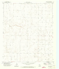
1970 Map of Morton NW
USGS Topo · Published 1973About this map
Armstrong sits in the southeastern corner of this High Plains landscape, a terrain marked by subtle depressions and the critical infrastructure of West Texas agriculture. Documented by the Texas Water Development Board and the Geological Survey in the late 1960s, the map reveals an environment defined by water management in an arid region. The sheer density of labels for Well and Wells across the grid indicates the intensity of subsurface water extraction and ranching activity during this era. Unlike more varied topographies, this quadrangle highlights the intersection of surveying and resource management, where every Tank and water point is a vital landmark for understanding the land use and hydrology of Cochran County during the early 1970s.
Find a feature on this map
4 named features on this map. Tap any name to fly to it.
Don’t see what you’re looking for? This feature index may not catch every label — zoom into the map to look around manually.
Map Details
Editions of this 1970 Morton NW Map
2 editions found
Other maps of this area

1954 · Brownfield
USGS Topo · 1:250,000

1958 · Brownfield
USGS Topo · 1:250,000

1962 · Brownfield
USGS Topo · 1:250,000

1969 · Maple
USGS Topo · 1:24,000

1969 · Enochs
USGS Topo · 1:24,000

1969 · Lehman
USGS Topo · 1:24,000

1970 · Lingo
USGS Topo · 1:24,000

1970 · Bledsoe
USGS Topo · 1:24,000

1970 · Morton SW
USGS Topo · 1:24,000

1970 · Morton NW
USGS Topo · 1:24,000