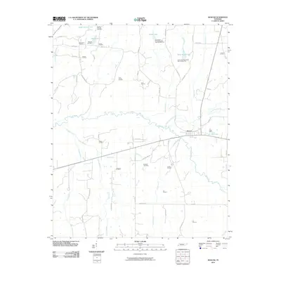
2010 Map of Moscow
USGS Topo · Published 2010About this map
The Wolf River meanders across the center of this Fayette County landscape, marking the northern edge of Moscow, Tennessee. The town is situated at a critical hydraulic and transit juncture, where the North Fork Wolf River joins the main stem near the R L Lewis Dam. The surrounding countryside is defined by an extensive network of family and community landmarks, particularly evident in the high density of rural burial grounds such as Mount Zion Cemetery, Good Springs Cemetery, and Bethlehem Cemetery.
Find a feature on this map
60 named features on this map. Tap any name to fly to it.
Don’t see what you’re looking for? This feature index may not catch every label — zoom into the map to look around manually.
Map Details
Editions of this 2010 Moscow Map
This is the sole edition of this map. No revisions or reprints were ever made.
Other maps of this area

1943 · Collierville
USGS Topo · 1:62,500

1948 · Byhalia
USGS Topo · 1:62,500

1949 · Moscow
USGS Topo · 1:62,500

1953 · Holly Springs
USGS Topo · 1:62,500

1953 · Collierville
USGS Topo · 1:50,000

1956 · Blytheville
USGS Topo · 1:250,000

1956 · Tupelo
USGS Topo · 1:250,000

1958 · Tupelo
USGS Topo · 1:250,000

1959 · Blytheville
USGS Topo · 1:250,000

1965 · Rossville
USGS Topo · 1:24,000