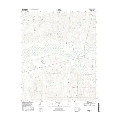
2016 Map of Moscow
USGS Topo · Published 2016About this map
The Wolf River and its marshy Running Slough dominate the landscape of Fayette County in this survey, carving a broad wetland corridor just north of Moscow. This area of West Tennessee is characterized by a high density of small family and community burial grounds, reflecting generations of rural settlement patterns. Genealogists will find a wealth of specific landmarks including Mount Zion Cem, Bethlehem Cem, and Pleasant Grove Cem, many of which sit near established roads like Bethlehem RD. The confluence of the N Fork Wolf River and various tributaries such as Grissum Cr and Stout Cr illustrates the complex drainage of the Wolf River basin. Small rural hubs like Hays are situated along the transit lines that connect this agricultural region to the larger town of Moscow.
Find a feature on this map
71 named features on this map. Tap any name to fly to it.
Don’t see what you’re looking for? This feature index may not catch every label — zoom into the map to look around manually.
Map Details
Editions of this 2016 Moscow Map
This is the sole edition of this map. No revisions or reprints were ever made.
Other maps of this area

1943 · Collierville
USGS Topo · 1:62,500

1948 · Byhalia
USGS Topo · 1:62,500

1949 · Moscow
USGS Topo · 1:62,500

1953 · Holly Springs
USGS Topo · 1:62,500

1953 · Collierville
USGS Topo · 1:50,000

1956 · Blytheville
USGS Topo · 1:250,000

1956 · Tupelo
USGS Topo · 1:250,000

1958 · Tupelo
USGS Topo · 1:250,000

1959 · Blytheville
USGS Topo · 1:250,000

1965 · Rossville
USGS Topo · 1:24,000