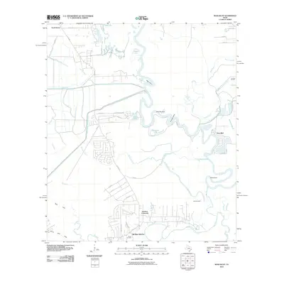
2010 Map of Moss Bluff
USGS Topo · Published 2010About this map
The Trinity River snakes through a complex landscape of wetlands and engineered waterways in this coastal Texas region. The river's winding path creates distinct landforms such as Negro Bend, Dead Ray Bend, and Demijohn Bend, while older channels remain as The Cutoff and Old River. Human intervention is evident in the straight lines of the Coastal Water Authority Canal and the West Branch Devers Canal, which cut across the natural drainage patterns of Big Caney Creek and Swinney Marsh. Settlement is concentrated in the southern and eastern portions of the map. Old River-Winfree and the Old River Community occupy the lower reaches, while the namesake Moss Bluff sits near a sharp turn in the river. Genealogists can locate Quarters Cemetery in the north and Reeves Cemetery near the southern boundary, reflecting the long-standing community roots in these river-bottom lands.
Find a feature on this map
60 named features on this map. Tap any name to fly to it.
Don’t see what you’re looking for? This feature index may not catch every label — zoom into the map to look around manually.
Map Details
Editions of this 2010 Moss Bluff Map
This is the sole edition of this map. No revisions or reprints were ever made.
Other maps of this area

1916 · Cedar Bayou
USGS Topo · 1:24,000

1919 · Cedar Bayou
USGS Topo · 1:31,680

1942 · Anahuac
USGS Topo · 1:24,000

1943 · Liberty
USGS Topo · 1:125,000

1943 · Cedar Bayou
USGS Topo · 1:24,000

1950 · Houston
USGS Topo · 1:250,000

1954 · Beaumont
USGS Topo · 1:250,000

1955 · Daisetta
USGS Topo · 1:62,500

1955 · Liberty
USGS Topo · 1:62,500

1956 · Houston
USGS Topo · 1:250,000