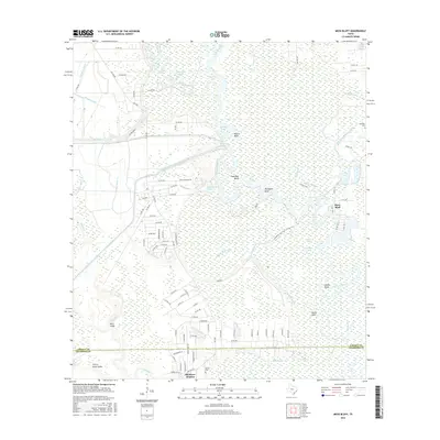
2016 Map of Moss Bluff
USGS Topo · Published 2016About this map
The Trinity River snakes through the bottomlands of Liberty and Chambers counties, defining a landscape shaped by water and slow-moving bayous. This area, anchored by the settlement of Moss Bluff, shows a complex network of man-made irrigation and transport channels, including the Coastal Water Authority Canal, Dayton Canal, and the West Branch Devers Canal. These features highlight the importance of water management in the coastal prairie and marshlands of Southeast Texas.
Find a feature on this map
109 named features on this map. Tap any name to fly to it.
Don’t see what you’re looking for? This feature index may not catch every label — zoom into the map to look around manually.
Map Details
Editions of this 2016 Moss Bluff Map
This is the sole edition of this map. No revisions or reprints were ever made.
Other maps of this area

1916 · Cedar Bayou
USGS Topo · 1:24,000

1919 · Cedar Bayou
USGS Topo · 1:31,680

1942 · Anahuac
USGS Topo · 1:24,000

1943 · Liberty
USGS Topo · 1:125,000

1943 · Cedar Bayou
USGS Topo · 1:24,000

1950 · Houston
USGS Topo · 1:250,000

1954 · Beaumont
USGS Topo · 1:250,000

1955 · Daisetta
USGS Topo · 1:62,500

1955 · Liberty
USGS Topo · 1:62,500

1956 · Houston
USGS Topo · 1:250,000