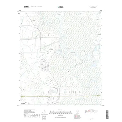
2019 Map of Moss Bluff
USGS Topo · Published 2019About this map
The Trinity River winds through a dense network of marshes and oxbow lakes in this section of Southeast Texas, where the landscape is defined by its complex hydrology. Meanders like Negro Bend and Demijohn Bend reveal the river's historical path, while modern infrastructure is represented by the Coastal Water Authority Canal and the Dayton Canal. The settlement of Moss Bluff sits near the eastern edge, supported by numerous water sources including Moss Spring and Wooten Lake.
Find a feature on this map
112 named features on this map. Tap any name to fly to it.
Don’t see what you’re looking for? This feature index may not catch every label — zoom into the map to look around manually.
Map Details
Editions of this 2019 Moss Bluff Map
This is the sole edition of this map. No revisions or reprints were ever made.
Other maps of this area

1916 · Cedar Bayou
USGS Topo · 1:24,000

1919 · Cedar Bayou
USGS Topo · 1:31,680

1942 · Anahuac
USGS Topo · 1:24,000

1943 · Liberty
USGS Topo · 1:125,000

1943 · Cedar Bayou
USGS Topo · 1:24,000

1950 · Houston
USGS Topo · 1:250,000

1954 · Beaumont
USGS Topo · 1:250,000

1955 · Daisetta
USGS Topo · 1:62,500

1955 · Liberty
USGS Topo · 1:62,500

1956 · Houston
USGS Topo · 1:250,000