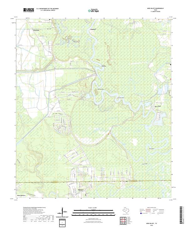
2022 Map of Moss Bluff
USGS Topo · Published 2022About this map
The Trinity River dominates this portion of Liberty and Chambers counties, carving a serpentine path through the low-lying Texas coastal plain. This 2022 survey documents a landscape defined by water management and natural drainage, where major engineering works like the Coastal Water Authority Canal and Lynchburg Canal intersect with primitive marshlands. The river's winding course creates several distinctive landforms, including Demijohn Bend and Marks Bend, while old oxbows have formed isolated water bodies like Basin Lake and Wooten Lake.
Find a feature on this map
117 named features on this map. Tap any name to fly to it.
Don’t see what you’re looking for? This feature index may not catch every label — zoom into the map to look around manually.
Map Details
Editions of this 2022 Moss Bluff Map
This is the sole edition of this map. No revisions or reprints were ever made.
Other maps of this area

1916 · Cedar Bayou
USGS Topo · 1:24,000

1919 · Cedar Bayou
USGS Topo · 1:31,680

1942 · Anahuac
USGS Topo · 1:24,000

1943 · Liberty
USGS Topo · 1:125,000

1943 · Cedar Bayou
USGS Topo · 1:24,000

1950 · Houston
USGS Topo · 1:250,000

1954 · Beaumont
USGS Topo · 1:250,000

1955 · Daisetta
USGS Topo · 1:62,500

1955 · Liberty
USGS Topo · 1:62,500

1956 · Houston
USGS Topo · 1:250,000