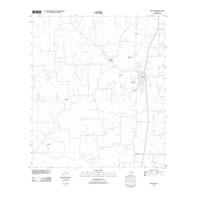
2010 Map of Moulton
USGS Topo · Published 2010About this map
Moulton serves as the central hub of this Lavaca County landscape, situated where the grid of farm-to-market roads meets the Lavaca River. The map reveals a fascinating layering of settlement history, specifically the geographic shift from Old Moulton to the contemporary townsite. This transition is marked by the presence of both the Old Moulton Cemetery and the Slavonic Cemetery, which point to the diverse heritage of the early residents in this part of Texas.
Find a feature on this map
65 named features on this map. Tap any name to fly to it.
Don’t see what you’re looking for? This feature index may not catch every label — zoom into the map to look around manually.
Map Details
Editions of this 2010 Moulton Map
This is the sole edition of this map. No revisions or reprints were ever made.
Other maps of this area

1901 · Flatonia
USGS Topo · 1:125,000

1953 · Seguin
USGS Topo · 1:250,000

1958 · Seguin
USGS Topo · 1:250,000

1959 · Hamon
USGS Topo · 1:24,000

1962 · Dilworth
USGS Topo · 1:24,000

1964 · Waelder
USGS Topo · 1:24,000

1965 · Wied
USGS Topo · 1:24,000

1965 · Komensky
USGS Topo · 1:24,000

1965 · Flatonia
USGS Topo · 1:24,000
1965 · Flatonia NW
USGS Topo · 1:24,000