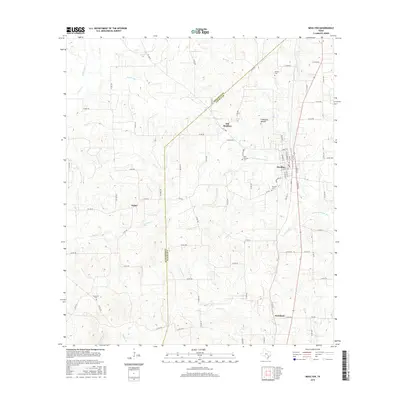
2016 Map of Moulton
USGS Topo · Published 2016About this map
The Lavaca River and its numerous tributaries, including the W Prong Lavaca River, define this South Texas landscape along the border of Gonzales and Lavaca counties. The town of Moulton serves as the primary hub, showing a clear grid of residential streets like Pecan St and Main St. The map reveals the historical progression of local settlement, specifically the distance between the modern town site and the original community at Old Moulton to the northwest.
Find a feature on this map
89 named features on this map. Tap any name to fly to it.
Don’t see what you’re looking for? This feature index may not catch every label — zoom into the map to look around manually.
Map Details
Editions of this 2016 Moulton Map
This is the sole edition of this map. No revisions or reprints were ever made.
Other maps of this area

1901 · Flatonia
USGS Topo · 1:125,000

1953 · Seguin
USGS Topo · 1:250,000

1958 · Seguin
USGS Topo · 1:250,000

1959 · Hamon
USGS Topo · 1:24,000

1962 · Dilworth
USGS Topo · 1:24,000

1964 · Waelder
USGS Topo · 1:24,000

1965 · Wied
USGS Topo · 1:24,000

1965 · Komensky
USGS Topo · 1:24,000

1965 · Flatonia
USGS Topo · 1:24,000
1965 · Flatonia NW
USGS Topo · 1:24,000