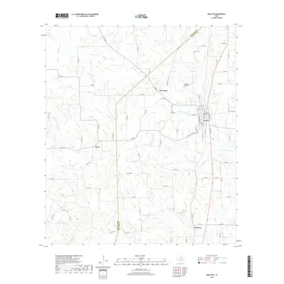
2019 Map of Moulton
USGS Topo · Published 2019About this map
Moulton serves as the primary hub in this portion of south-central Texas, where the terrain is defined by the headwaters of the Lavaca River and its numerous tributaries. The landscape preserves the distinct locations of Old Moulton and its nearby Old Moulton Cem, reflecting the shifting patterns of settlement in the area. Water drainage dictates the rural layout, with Sulphur Br and Bear Br carving paths through the northern sections while Kuehns Cr and Ponton Cr flow toward the southern boundary near Henkhaus. Genealogists will find several dedicated burial sites, including the Slavonic Cem and Burkett Cem, which speak to the local heritage of the families residing between the Lavaca and Gonzales county lines. The presence of Frederick Mound provides a singular natural landmark amidst the creek-fed prairies and agricultural road networks.
Find a feature on this map
87 named features on this map. Tap any name to fly to it.
Don’t see what you’re looking for? This feature index may not catch every label — zoom into the map to look around manually.
Map Details
Editions of this 2019 Moulton Map
This is the sole edition of this map. No revisions or reprints were ever made.
Other maps of this area

1901 · Flatonia
USGS Topo · 1:125,000

1953 · Seguin
USGS Topo · 1:250,000

1958 · Seguin
USGS Topo · 1:250,000

1959 · Hamon
USGS Topo · 1:24,000

1962 · Dilworth
USGS Topo · 1:24,000

1964 · Waelder
USGS Topo · 1:24,000

1965 · Wied
USGS Topo · 1:24,000

1965 · Komensky
USGS Topo · 1:24,000

1965 · Flatonia
USGS Topo · 1:24,000
1965 · Flatonia NW
USGS Topo · 1:24,000