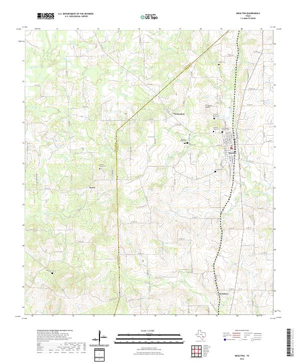
2022 Map of Moulton
USGS Topo · Published 2022About this map
The Lavaca River and its numerous tributaries, including Kuehns Cr and Ponton Cr, define the drainage of this south-central Texas landscape along the Gonzales and Lavaca county line. The settlement of Moulton serves as the primary hub, while the nearby site of Old Moulton reflects the shifting nature of rural centers over time. For genealogists, the area is notably dense with burial sites, ranging from the large Saint Joseph Catholic Cem and Slavonic Cem to smaller, private locations like the Freidrich Family Plot and the Bunting Family Cem. The terrain is marked by gentle undulations, punctuated by the distinct elevation of Frederick Mound. This modern survey records the persistent rural character of the region, where isolated communities like Nickel and Henkhaus remain connected by a network of farm-to-market roads and county routes crossing various creeks such as Sulphur Br and Peach Cr.
Find a feature on this map
100 named features on this map. Tap any name to fly to it.
Don’t see what you’re looking for? This feature index may not catch every label — zoom into the map to look around manually.
Map Details
Editions of this 2022 Moulton Map
This is the sole edition of this map. No revisions or reprints were ever made.
Other maps of this area

1901 · Flatonia
USGS Topo · 1:125,000

1953 · Seguin
USGS Topo · 1:250,000

1958 · Seguin
USGS Topo · 1:250,000

1959 · Hamon
USGS Topo · 1:24,000

1962 · Dilworth
USGS Topo · 1:24,000

1964 · Waelder
USGS Topo · 1:24,000

1965 · Wied
USGS Topo · 1:24,000

1965 · Komensky
USGS Topo · 1:24,000

1965 · Flatonia
USGS Topo · 1:24,000
1965 · Flatonia NW
USGS Topo · 1:24,000