
1969 Map of Mound Lake
USGS Topo · Published 1971About this map
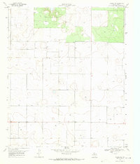
Mound Lake dominates this High Plains landscape, straddling the county line between Terry and Lynn. In the late 1960s, the area surrounding this saline basin was defined by a mix of natural drainage and industrial resource extraction, notably marked by several Oil Wells and a Gravel Pit. The terrain is characterized by the winding path of Lost Draw to the southwest and numerous smaller water features like Punch Bowl Tank and various named Wells.
Find a feature on this map
13 named features on this map. Tap any name to fly to it.
Don’t see what you’re looking for? This feature index may not catch every label — zoom into the map to look around manually.
Map Details
Editions of this 1969 Mound Lake Map
This is the sole edition of this map. No revisions or reprints were ever made.
Other maps of this area

1954 · Lubbock
USGS Topo · 1:250,000

1954 · Brownfield
USGS Topo · 1:250,000

1957 · New Home
USGS Topo · 1:62,500

1957 · Meadow
USGS Topo · 1:62,500

1958 · Brownfield
USGS Topo · 1:250,000

1962 · Brownfield
USGS Topo · 1:250,000

1969 · Brownfield East
USGS Topo · 1:24,000

1969 · New Moore
USGS Topo · 1:24,000
1969 · Tahoka SW
USGS Topo · 1:24,000

1969 · Double Lakes
USGS Topo · 1:24,000