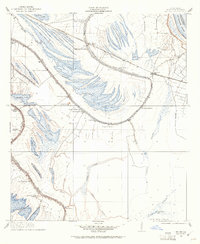
1909 Map of Mound
USGS Topo · Published 1961About this map
California Plantation and Alcadone Plantation define the agricultural landscape of this Madison Parish region in the early twentieth century. The terrain is a complex network of bayous and oxbow lakes, where the Mississippi River has left a legacy of curved water bodies like Texas Lake and Six Lake. The distribution of Mound Plantation and Texas Plantation following the natural levees shows how local industry relied on the fertile alluvial soil and proximity to the Vicksburg Shreveport and Pacific railroad line.
Find a feature on this map
44 named features on this map. Tap any name to fly to it.
Don’t see what you’re looking for? This feature index may not catch every label — zoom into the map to look around manually.
Map Details
Editions of this 1909 Mound Map
2 editions found
Other maps of this area

1909 · Millikens Bend
USGS Topo · 1:24,000

1909 · Tallulah
USGS Topo · 1:24,000

1909 · Mound
USGS Topo · 1:24,000

1910 · Mound
USGS Topo · 1:31,680

1918 · Vicksburg
USGS Topo · 1:62,500

1939 · Talla Bena
USGS Topo · 1:62,500

1939 · Yokena
USGS Topo · 1:62,500

1941 · Vicksburg
USGS Topo · 1:62,500

1955 · Jackson
USGS Topo · 1:250,000

1961 · Jackson
USGS Topo · 1:250,000