
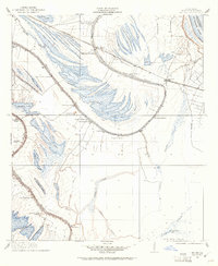
1909 Map of Mound
USGS Topo · Published 1909About this map
The Vicksburg Shreveport and Pacific Railroad cuts through a landscape of meander scars and oxbow lakes just west of the Mississippi River. This corner of Madison Parish is defined by its extensive plantation system, where names like Alcadone Plantation, Texas Plantation, and California Plantation line the fertile soils between the bayous. The settlement pattern follows the intricate drainage network, with homes and structures clustered along the banks of Bayou Walnut and Bayou Roundaway.
Find a feature on this map
39 named features on this map. Tap any name to fly to it.
Don’t see what you’re looking for? This feature index may not catch every label — zoom into the map to look around manually.
Map Details
Editions of this 1909 Mound Map
2 editions found
Other maps of this area

1909 · Millikens Bend
USGS Topo · 1:24,000

1909 · Tallulah
USGS Topo · 1:24,000

1910 · Mound
USGS Topo · 1:31,680

1918 · Vicksburg
USGS Topo · 1:62,500

1939 · Talla Bena
USGS Topo · 1:62,500

1939 · Yokena
USGS Topo · 1:62,500

1941 · Vicksburg
USGS Topo · 1:62,500

1955 · Jackson
USGS Topo · 1:250,000

1961 · Jackson
USGS Topo · 1:250,000

1962 · Jackson
USGS Topo · 1:250,000