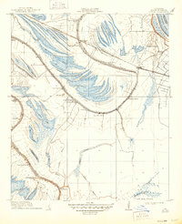
1910 Map of Mound
USGS Topo · Published 1949About this map
The alluvial landscape of Madison Parish is defined here by the complex movement of the Mississippi River, creating a network of ridges, backswamps, and oxbow remnants like Compton Lake and Texas Lake. In the early twentieth century, this region was dominated by large agricultural holdings, including California Plantation, Killarney Plantation, and Texas Plantation, which relied on the Vicksburg Shreveport and Pacific R. R. for transport. Small commercial hubs such as Mexico Store and Blue Front Store served the dispersed population, while spiritual life was anchored at Solomons Temple Church and St Johns Church. Evidence of much earlier habitation remains visible at the Indian Mounds near Mound Plantation. The intricate drainage system of Walnut Bayou and Brushy Bayou highlights the historical challenges of managing the Fifth Louisiana Levee District before modern flood control measures were fully realized.
Find a feature on this map
43 named features on this map. Tap any name to fly to it.
Don’t see what you’re looking for? This feature index may not catch every label — zoom into the map to look around manually.
Map Details
Editions of this 1910 Mound Map
2 editions found
Other maps of this area

1909 · Millikens Bend
USGS Topo · 1:24,000

1909 · Tallulah
USGS Topo · 1:24,000

1909 · Mound
USGS Topo · 1:24,000

1910 · Mound
USGS Topo · 1:31,680

1918 · Vicksburg
USGS Topo · 1:62,500

1939 · Talla Bena
USGS Topo · 1:62,500

1939 · Yokena
USGS Topo · 1:62,500

1941 · Vicksburg
USGS Topo · 1:62,500

1955 · Jackson
USGS Topo · 1:250,000

1961 · Jackson
USGS Topo · 1:250,000