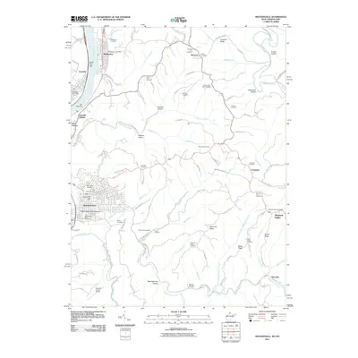
2011 Map of Moundsville
USGS Topo · Published 2011About this map
The Grave Creek Indian Mound stands as a prominent landmark in the heart of Moundsville, anchoring a landscape where ancient history meets modern institutional development. This 2011 survey details the dense riverfront settlement along the Ohio River, dominated by the massive footprint of the West Virginia State Penitentiary and nearby industrial and civic infrastructure. The terrain rises sharply from the riverbanks into a series of ridges and hollows, including Sorghum Ridge and Bald Eagle Hollow, which are dotted with numerous small family and community burial grounds such as the Shafer Farm Cemetery and McHenry Cemetery. To the north, the town of McMechen follows the narrow strip between the water and the hills, while the southern reaches transitions toward the Marshall County Airport. The map's high density of cemeteries, including the Prison Cemetery, provides a unique geographic record of the region's social and institutional history.
Find a feature on this map
106 named features on this map. Tap any name to fly to it.
Don’t see what you’re looking for? This feature index may not catch every label — zoom into the map to look around manually.
Map Details
Editions of this 2011 Moundsville Map
This is the sole edition of this map. No revisions or reprints were ever made.
Other maps of this area

1902 · Wheeling
USGS Topo · 1:62,500

1904 · Cameron
USGS Topo · 1:62,500

1905 · Clarington
USGS Topo · 1:62,500

1905 · St. Clairsville
USGS Topo · 1:62,500

1935 · Cameron
USGS Topo · 1:62,500

1935 · Clarington
USGS Topo · 1:62,500

1935 · Wheeling
USGS Topo · 1:62,500

1940 · Clarington
USGS Topo · 1:62,500

1942 · Cameron
USGS Topo · 1:62,500

1942 · Wheeling
USGS Topo · 1:62,500