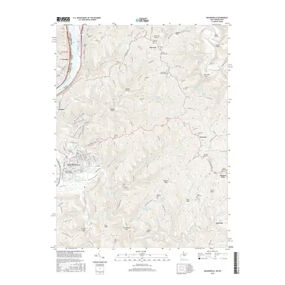
2016 Map of Moundsville
USGS Topo · Published 2016About this map
Moundsville and the Ohio River dominate the western edge of this 2016 survey, where the ancient Grave Creek Indian Mound stands as a landmark amidst the modern city grid. The landscape quickly transitions from the river valley into a complex network of ridges and hollows, including Fork Ridge, Waymans Ridge, and Sorghum Ridge. These uplands are dotted with small rural communities like Sherrard, Limestone, and Pleasant Valley, each connected by winding roads that follow the high ground above drainages like Middle Grave Cr and Little Grave Cr.
Find a feature on this map
85 named features on this map. Tap any name to fly to it.
Don’t see what you’re looking for? This feature index may not catch every label — zoom into the map to look around manually.
Map Details
Editions of this 2016 Moundsville Map
This is the sole edition of this map. No revisions or reprints were ever made.
Other maps of this area

1902 · Wheeling
USGS Topo · 1:62,500

1904 · Cameron
USGS Topo · 1:62,500

1905 · Clarington
USGS Topo · 1:62,500

1905 · St. Clairsville
USGS Topo · 1:62,500

1935 · Cameron
USGS Topo · 1:62,500

1935 · Clarington
USGS Topo · 1:62,500

1935 · Wheeling
USGS Topo · 1:62,500

1940 · Clarington
USGS Topo · 1:62,500

1942 · Cameron
USGS Topo · 1:62,500

1942 · Wheeling
USGS Topo · 1:62,500