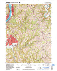
1997 Map of Moundsville
USGS Topo · Published 1999About this map
Moundsville serves as a prominent focal point in this West Virginia landscape, centered on the historic State Penitentiary and its associated Prison Farms. The industrial and correctional presence is significant, with facilities like the Camp Fairchance (Prison Camp) and a Limestone Quarry marking the hillsides. Along the Ohio River, the narrow corridor known as The Narrows channels transportation through McMechen and Glendale, where the CSX Transportation railroad parallels the riverbank.
Find a feature on this map
69 named features on this map. Tap any name to fly to it.
Don’t see what you’re looking for? This feature index may not catch every label — zoom into the map to look around manually.
Map Details
Editions of this 1997 Moundsville Map
This is the sole edition of this map. No revisions or reprints were ever made.
Other maps of this area

1902 · Wheeling
USGS Topo · 1:62,500

1904 · Cameron
USGS Topo · 1:62,500

1905 · Clarington
USGS Topo · 1:62,500

1905 · St. Clairsville
USGS Topo · 1:62,500

1935 · Cameron
USGS Topo · 1:62,500

1935 · Clarington
USGS Topo · 1:62,500

1935 · Wheeling
USGS Topo · 1:62,500

1940 · Clarington
USGS Topo · 1:62,500

1942 · Cameron
USGS Topo · 1:62,500

1942 · Wheeling
USGS Topo · 1:62,500