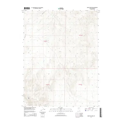
2014 Map of Mount Airy Mesa
USGS Topo · Published 2014About this map
Mt Airy Mesa dominates the southern reaches of this landscape in the Great Basin, rising above the surrounding desert floor. The terrain is defined by the ephemeral path of Antelope Cr, which drains toward the northeast through a series of complex canyons and ridges. This 2014 survey documents the remote character of the border between Nevada's Lander and Nevada counties, showing a landscape largely shaped by its natural topography rather than human settlement. The primary artery for navigation through this high-desert environment is Antelope Valley Rd, which skirts the western edge of the highlands. The map provides precise detail on the Public Land Survey System grids, specifically the intersections of t20n r41e and t20n r42e, which are essential for locating specific land parcels and historical claims in this expansive territory.
Find a feature on this map
7 named features on this map. Tap any name to fly to it.
Don’t see what you’re looking for? This feature index may not catch every label — zoom into the map to look around manually.
Map Details
Editions of this 2014 Mount Airy Mesa Map
This is the sole edition of this map. No revisions or reprints were ever made.
Other maps of this area

1955 · Millett
USGS Topo · 1:250,000

1956 · Austin
USGS Topo · 1:62,500

1959 · Millett
USGS Topo · 1:250,000

1969 · Mount Airy
USGS Topo · 1:24,000

1969 · Vigus Butte
USGS Topo · 1:24,000

1969 · Vigus Butte NW
USGS Topo · 1:24,000

1969 · Mount Airy NW
USGS Topo · 1:24,000

1969 · Mount Airy NE
USGS Topo · 1:24,000

1969 · Gandolfo Canyon
USGS Topo · 1:24,000

1969 · Mount Airy Mesa
USGS Topo · 1:24,000