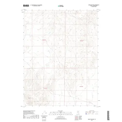
2018 Map of Mount Airy Mesa
USGS Topo · Published 2018About this map
Mt Airy Mesa dominates the southwestern quadrant of this high-desert landscape in Nevada’s Great Basin. The terrain is characterized by intricate contouring that illustrates the dramatic elevation changes across the mesa and surrounding ridges. Water is a scarce and defining element in this arid environment, represented by the ephemeral course of Antelope Creek, which winds northward through the central valleys. The map primarily documents the public land survey system divisions, showing the intersections of Townships 19 and 20 North with Ranges 41 and 42 East. These grid lines provide essential orientation for researchers examining land use and historical property boundaries in this sparsely populated section of Lander County.
Find a feature on this map
6 named features on this map. Tap any name to fly to it.
Don’t see what you’re looking for? This feature index may not catch every label — zoom into the map to look around manually.
Map Details
Editions of this 2018 Mount Airy Mesa Map
This is the sole edition of this map. No revisions or reprints were ever made.
Other maps of this area

1955 · Millett
USGS Topo · 1:250,000

1956 · Austin
USGS Topo · 1:62,500

1959 · Millett
USGS Topo · 1:250,000

1969 · Mount Airy
USGS Topo · 1:24,000

1969 · Vigus Butte
USGS Topo · 1:24,000

1969 · Vigus Butte NW
USGS Topo · 1:24,000

1969 · Mount Airy NW
USGS Topo · 1:24,000

1969 · Mount Airy NE
USGS Topo · 1:24,000

1969 · Gandolfo Canyon
USGS Topo · 1:24,000

1969 · Mount Airy Mesa
USGS Topo · 1:24,000