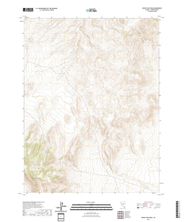
2021 Map of Mount Airy Mesa
USGS Topo · Published 2021About this map
Mt Airy Mesa rises above the high desert floor in Lander County, defining the topography of this corner of the Great Basin. This recent survey captures the modern drainage patterns of Antelope Cr as it winds through the basin floor between rising ridges. The landscape is structured by the Public Land Survey System, with the boundaries of t20n r41e, t20n r42e, t19n r41e, and t19n r42e providing a grid over the undulating terrain. This map serves as a primary record of the landforms and seasonal watercourses in a relatively undeveloped region, where the elevation changes around the mesa offer the most distinctive natural landmarks for navigation or land management.
Find a feature on this map
6 named features on this map. Tap any name to fly to it.
Don’t see what you’re looking for? This feature index may not catch every label — zoom into the map to look around manually.
Map Details
Editions of this 2021 Mount Airy Mesa Map
This is the sole edition of this map. No revisions or reprints were ever made.
Other maps of this area

1955 · Millett
USGS Topo · 1:250,000

1956 · Austin
USGS Topo · 1:62,500

1959 · Millett
USGS Topo · 1:250,000

1969 · Mount Airy
USGS Topo · 1:24,000

1969 · Vigus Butte
USGS Topo · 1:24,000

1969 · Vigus Butte NW
USGS Topo · 1:24,000

1969 · Mount Airy NW
USGS Topo · 1:24,000

1969 · Mount Airy NE
USGS Topo · 1:24,000

1969 · Gandolfo Canyon
USGS Topo · 1:24,000

1969 · Mount Airy Mesa
USGS Topo · 1:24,000