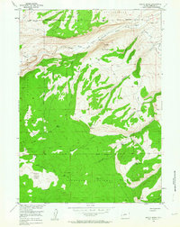
1953 Map of Mount Arter
USGS Topo · Published 1963About this map
The Wind River Indian Reservation meets the Shoshone National Forest in this high-altitude landscape, where the North Popo Agie River carves through deep canyons and basins. The terrain is marked by dramatic elevation changes, climbing from the riverbanks up to the summit of Mount Arter and the prominent Suicide Point. Early settlement patterns are visible through isolated outposts like the Pine Bar Ranch and Hart Ranch near the reservation boundary, alongside the Farlow Homestead situated south of Mormon Basin. These small holdings represent the persistence of ranching families in a landscape otherwise dominated by federal and tribal lands. Multiple pack trails connect these remote sites, crossing through high passes like Cony Pass and Cyclone Pass, which were essential for navigating the mountain ridges before modern road development.
Find a feature on this map
34 named features on this map. Tap any name to fly to it.
Don’t see what you’re looking for? This feature index may not catch every label — zoom into the map to look around manually.
Map Details
Editions of this 1953 Mount Arter Map
4 editions found
Other maps of this area

1937 · Moccasin Lake
USGS Topo · 1:48,000

1943 · Moccasin Lake
USGS Topo · 1:62,500

1952 · Ray Lake
USGS Topo · 1:24,000

1952 · Wind River
USGS Topo · 1:24,000

1953 · Sweetwater Gap
USGS Topo · 1:24,000

1953 · Cony Mountain
USGS Topo · 1:24,000

1953 · Mount Arter
USGS Topo · 1:24,000

1953 · Fossil Hill
USGS Topo · 1:24,000

1953 · Mount Arter SE
USGS Topo · 1:24,000

1955 · Lander
USGS Topo · 1:250,000