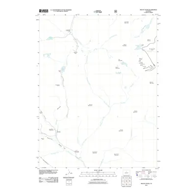
2011 Map of Mount Blue Sky
USGS Topo · Published 2011About this map
Mount Evans and Mount Bierstadt anchor this high-elevation landscape, where glacial cirques hold secluded waters like Abyss Lake, Frozen Lake, and the Chicago Lakes. The terrain is defined by its recreation and utility infrastructure, featuring the Geneva Basin Ski Area and the Harold D Roberts Tunnel, an ambitious subterranean water diversion project. At lower elevations, the mapping reveals a network of Forest Service facilities including the Geneva Park Campground and Duck Creek Picnic Area along the route to Guanella Pass. Human activity is further evidenced by the Roadside Mine near Bruno Gulch and the Altura Dam on Duck Lake, illustrating the balance of resource extraction and water management in this alpine environment. The presence of the Shelter Cabin near Summit Lake highlights the era's focus on backcountry safety for those navigating the high peaks of the Front Range.
Find a feature on this map
48 named features on this map. Tap any name to fly to it.
Don’t see what you’re looking for? This feature index may not catch every label — zoom into the map to look around manually.
Map Details
Editions of this 2011 Mount Blue Sky Map
This is the sole edition of this map. No revisions or reprints were ever made.
Other maps of this area

1903 · Georgetown
USGS Topo · 1:62,500

1905 · Georgetown
USGS Topo · 1:62,500

1924 · Montezuma
USGS Topo · 1:62,500

1926 · Montezuma
USGS Topo · 1:62,500

1933 · Montezuma
USGS Topo · 1:62,500

1937 · Como
USGS Topo · 1:62,500

1945 · Shawnee
USGS Topo · 1:24,000

1945 · Mount Logan
USGS Topo · 1:24,000

1948 · Mount Logan
USGS Topo · 1:24,000

1948 · Shawnee
USGS Topo · 1:24,000