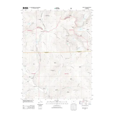
2013 Map of Mount Blue Sky
USGS Topo · Published 2013About this map
Mount Evans and Mount Bierstadt dominate this high-altitude landscape along the border of Clear Creek and Park counties. This 2013 survey illustrates a region defined by recreational infrastructure and water management within the Arapaho and Pike National Forests. The mapping of the Harold D Roberts Tunnel beneath the peaks highlights the complex engineering required for trans-mountain water diversion. Notable social and recreational hubs include the Guanella Pass Campground, the Geneva Basin Ski Area, and several high-altitude trails like the Mt Bierstadt Trail. Glacial features such as The Sawtooth ridge and alpine basins containing Abyss Lake, Summit Lake, and Naylor Lake are clearly delineated, showing the drainage patterns of Duck Creek and Scott Gomer Creek that feed the lower valleys.
Find a feature on this map
68 named features on this map. Tap any name to fly to it.
Don’t see what you’re looking for? This feature index may not catch every label — zoom into the map to look around manually.
Map Details
Editions of this 2013 Mount Blue Sky Map
This is the sole edition of this map. No revisions or reprints were ever made.
Other maps of this area

1903 · Georgetown
USGS Topo · 1:62,500

1905 · Georgetown
USGS Topo · 1:62,500

1924 · Montezuma
USGS Topo · 1:62,500

1926 · Montezuma
USGS Topo · 1:62,500

1933 · Montezuma
USGS Topo · 1:62,500

1937 · Como
USGS Topo · 1:62,500

1945 · Shawnee
USGS Topo · 1:24,000

1945 · Mount Logan
USGS Topo · 1:24,000

1948 · Mount Logan
USGS Topo · 1:24,000

1948 · Shawnee
USGS Topo · 1:24,000