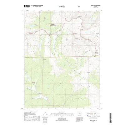
2019 Map of Mount Blue Sky
USGS Topo · Published 2019About this map
Guanella Pass serves as a central high-altitude waypoint on this 2019 survey of the Front Range, where the high peaks of Arapaho National Forest and Pike National Forest converge. The landscape is dominated by the massive profile of Mt Evans and Mt Bierstadt, connected by the sharp ridge known as The Sawtooth. This geography dictates a radial drainage pattern, with waters flowing through alpine basins like Abyss Lake, Frozen Lake, and the tiered Chicago Lakes.
Find a feature on this map
55 named features on this map. Tap any name to fly to it.
Don’t see what you’re looking for? This feature index may not catch every label — zoom into the map to look around manually.
Map Details
Editions of this 2019 Mount Blue Sky Map
This is the sole edition of this map. No revisions or reprints were ever made.
Other maps of this area

1903 · Georgetown
USGS Topo · 1:62,500

1905 · Georgetown
USGS Topo · 1:62,500

1924 · Montezuma
USGS Topo · 1:62,500

1926 · Montezuma
USGS Topo · 1:62,500

1933 · Montezuma
USGS Topo · 1:62,500

1937 · Como
USGS Topo · 1:62,500

1945 · Shawnee
USGS Topo · 1:24,000

1945 · Mount Logan
USGS Topo · 1:24,000

1948 · Mount Logan
USGS Topo · 1:24,000

1948 · Shawnee
USGS Topo · 1:24,000