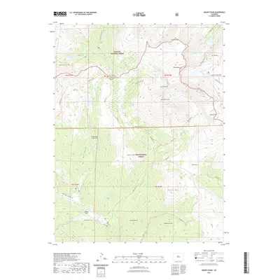
2022 Map of Mount Blue Sky
USGS Topo · Published 2022About this map
Mt Evans and Mt Bierstadt anchor this high-altitude landscape where the boundaries of the Arapaho National Forest and Pike National Forest meet. This modern survey details the complex drainage systems that flow from the glacial cirques, including Scott Gomer Cr, Chicago Cr, and Lake Fork. The presence of the Harold D Roberts Tunnel cutting through the subsurface near Geneva Park highlights the critical role this terrain plays in regional water management, even as the surface remains dedicated to preservation and recreation.
Find a feature on this map
53 named features on this map. Tap any name to fly to it.
Don’t see what you’re looking for? This feature index may not catch every label — zoom into the map to look around manually.
Map Details
Editions of this 2022 Mount Blue Sky Map
This is the sole edition of this map. No revisions or reprints were ever made.
Other maps of this area

1903 · Georgetown
USGS Topo · 1:62,500

1905 · Georgetown
USGS Topo · 1:62,500

1924 · Montezuma
USGS Topo · 1:62,500

1926 · Montezuma
USGS Topo · 1:62,500

1933 · Montezuma
USGS Topo · 1:62,500

1937 · Como
USGS Topo · 1:62,500

1945 · Shawnee
USGS Topo · 1:24,000

1945 · Mount Logan
USGS Topo · 1:24,000

1948 · Mount Logan
USGS Topo · 1:24,000

1948 · Shawnee
USGS Topo · 1:24,000