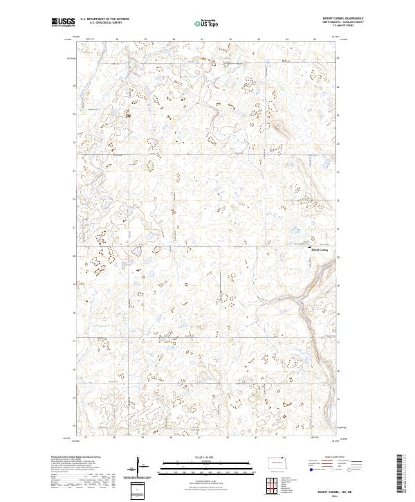
2024 Map of Mount Carmel
USGS Topo · Published 2024About this map
Mount Carmel serves as the focal point for this rural expanse in North Dakota, where the landscape is defined by the organized grid of the Public Land Survey System and a network of gravel roads. The settlement is anchored by the Mount Carmel Catholic Cem, a site of local genealogical significance. Much of the surrounding terrain is dedicated to conservation, notably the Cavalier County Waterfowl Production Area, which protects the pothole wetlands characteristic of this prairie region. Water drainage in the area is guided by the Little South Pembina River in the southeast and Mowbray Creek in the northwest. This modern survey demonstrates the persistence of the township-and-range agricultural layout, where thoroughfares like Maida Rd and Dresden Rd connect isolated farmsteads and managed natural areas across the plains.
Find a feature on this map
26 named features on this map. Tap any name to fly to it.
Don’t see what you’re looking for? This feature index may not catch every label — zoom into the map to look around manually.
Map Details
Editions of this 2024 Mount Carmel Map
This is the sole edition of this map. No revisions or reprints were ever made.
Other maps of this area

1953 · Devils Lake
USGS Topo · 1:250,000

1956 · Devils Lake
USGS Topo · 1:250,000

1967 · Langdon East
USGS Topo · 1:24,000

1967 · Maida
USGS Topo · 1:24,000

1970 · Mount Carmel
USGS Topo · 1:24,000

1970 · Wales
USGS Topo · 1:24,000

1970 · Hannah SE
USGS Topo · 1:24,000

1970 · Langdon West
USGS Topo · 1:24,000

1985 · Langdon
USGS Topo · 1:100,000
2011 · Wales
USGS Topo · 1:24,000