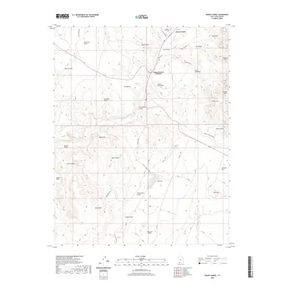
2020 Map of Mount Carmel
USGS Topo · Published 2020About this map
Mount Carmel and Mount Carmel Junction serve as the primary human touchpoints in this transition of the Kane County landscape. The topography is defined by the E Fork Virgin River as it cuts southward through Parunuweap Canyon, flanked by the towering White Cliffs and Elkheart Cliffs. The settlement pattern follows the narrow corridor of Long Valley, where the Mount Carmel Cem remains a significant marker of local heritage. To the east, the landscape opens into the distinctive Glendale Bench and the high point of Dianas Throne. Water sources like Moncur Spring and the drainage of Sand Wash illustrate the critical nature of hydrology in this arid environment, while various family-named canyons, such as Joseph Canyon and Sethys Canyon, suggest a long history of local land use and ranching.
Find a feature on this map
45 named features on this map. Tap any name to fly to it.
Don’t see what you’re looking for? This feature index may not catch every label — zoom into the map to look around manually.
Map Details
Editions of this 2020 Mount Carmel Map
This is the sole edition of this map. No revisions or reprints were ever made.
Other maps of this area

1886 · Kanab
USGS Topo · 1:250,000

1953 · Cedar City
USGS Topo · 1:250,000

1954 · Kanab SW
USGS Topo · 1:24,000

1954 · Orderville Canyon SE
USGS Topo · 1:24,000

1954 · Kanab SE
USGS Topo · 1:24,000
1956 · Springdale SE
USGS Topo · 1:24,000

1956 · Springdale NE
USGS Topo · 1:24,000

1957 · Kanab
USGS Topo · 1:62,500

1958 · Cedar City
USGS Topo · 1:250,000

1958 · Orderville
USGS Topo · 1:62,500