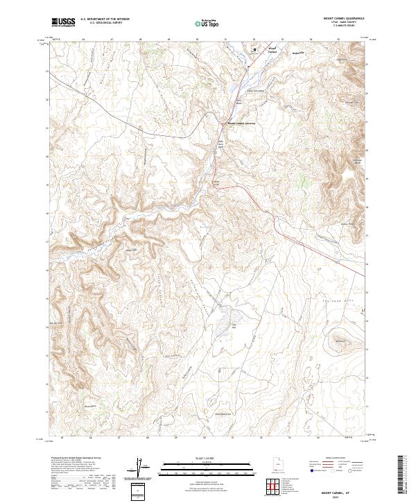
2023 Map of Mount Carmel
USGS Topo · Published 2023About this map
Mount Carmel and neighboring Orderville anchor the northern reaches of this Kane County landscape, where modern road networks meet deep geologic time. The settlements follow the path of Muddy Creek and the East Fork Virgin River, tracing a corridor of habitation between the massive escarpments of the White Cliffs and the Elkheart Cliffs. The transition from the high Glendale Bench to the dramatic depths of Parunuweap Canyon illustrates the complex erosion patterns of the Colorado Plateau. Genealogists will find the Mount Carmel Cem positioned near the river, a vital landmark for local history. Southward, the terrain shifts into the open expanses of The Sand Hills and the prominent Dianas Throne, while named drainages like Yellowjacket Canyon and Joseph Canyon score the high mesas, revealing the intricate watercourses that have shaped the region's topography.
Find a feature on this map
43 named features on this map. Tap any name to fly to it.
Don’t see what you’re looking for? This feature index may not catch every label — zoom into the map to look around manually.
Map Details
Editions of this 2023 Mount Carmel Map
This is the sole edition of this map. No revisions or reprints were ever made.
Other maps of this area

1886 · Kanab
USGS Topo · 1:250,000

1953 · Cedar City
USGS Topo · 1:250,000

1954 · Kanab SW
USGS Topo · 1:24,000

1954 · Orderville Canyon SE
USGS Topo · 1:24,000

1954 · Kanab SE
USGS Topo · 1:24,000
1956 · Springdale SE
USGS Topo · 1:24,000

1956 · Springdale NE
USGS Topo · 1:24,000

1957 · Kanab
USGS Topo · 1:62,500

1958 · Cedar City
USGS Topo · 1:250,000

1958 · Orderville
USGS Topo · 1:62,500